Last week, I attended to the third in the series of four EMAPS sprints mapping climate change controversies. The focus of the sprint was on local adaptation projects: how they are defined, what they are, and where funding goes at the local level. This workshop, which took place at the School of Geography and the Environment at the University of Oxford, was based on the model of ‘hackathons’ organized by communities of programmers gather:
- coders
- designers
- issue experts of the climate debate
- specialists of digital methods
in small interdisciplinary groups to respond to the mapping needs of the alpha-users.

The group I was part of focused on how is the private sector helping fight climate change impacts. We first generated databases from reports and lists of projects recorded by the:
- United Nations Development Programme
- United Nations Framework Convention on Climate Change
- Organisation for Economic Co-operation and Development
- ClimateWise insurance industry’s group
- Geneva Association
- Willis Research Network
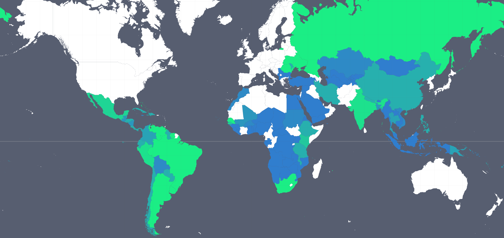
Then we explored the data to visualize them in different templates. The following world map describes the coverage of drought/water scarcity hazard by the public sector (blue) and the insurance industry (green).
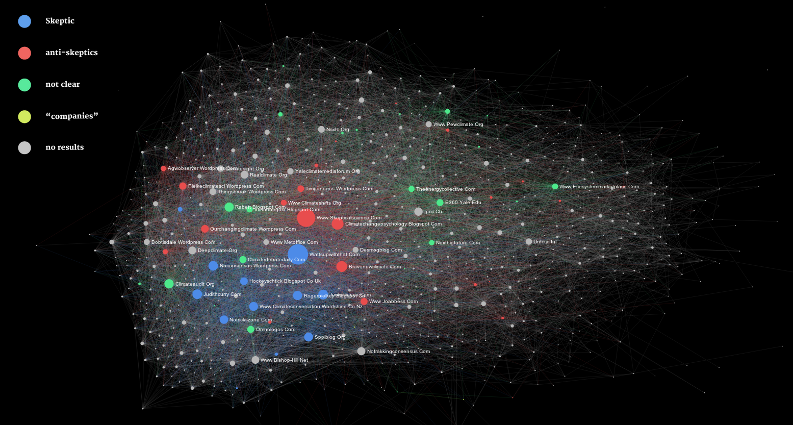
The following network explains who is talking about insurance themes within the adaptation online community showing that skeptics are more picking up on insurance themes.
Finally, I should also mention the delightful experience of being in Oxford again (3 times in the last 2 years), hosted in the impressive Keble College.
